About Wajir-West Constituency
Wajir West Constituency is a featureless plain and lies between 150 metres and 460 metres above sea level and along latitude 1°45'N and longitude 40°4'E. Its Altitude is 244 m (801ft.). The constituency is prone to seasonal flooding during the rainy seasons which makes roads impassable. The constituency has seasonal swamps which together with drainage lines serve as grazing zones during dry season and for cultivation during the rainy seasons. The seasonal swamps are in Lagboghol area. The constituency is generally covered with young sedimentary rocks with loamy soils.
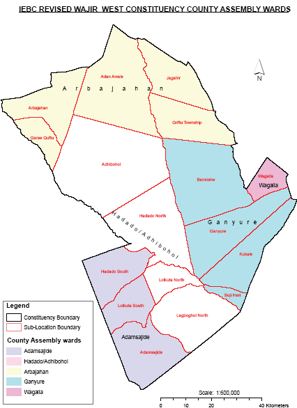
The constituency is one of the eight sub-counties of Wajir County. The others are Wajir East, Tarbaj, Eldas, Wajir North, Buna, Habaswein and Wajir South. The Constituency measures 10,043.6km2 and is made up of six (6) Divisions (Griftu, Arbajahan, Lagbogol, Hadado, Ademasajida and Wagalla
Read More